
Started the day cloudy and cool with temps in the 50s. As we entered the mountains the rain started again and temps dropped into the mid 40s. Could not see much because of the rain but at least it washed some of the mud off the camper.

The highway was better today with just a few bumps. Even though we were driving through the mountains the road followed the Rancheria River so it was pretty straight and not too steep.


We reached Teslin about 11:30AM and the rain finally stopped. It is a pretty little village by the Nisutlin River where it runs into Teslin Lake.

Our campground is by the lake with a pretty view of the mountains.
After lunch we went to the Tlingit Heritage Center which is a small museum just north of town.
.JPG)
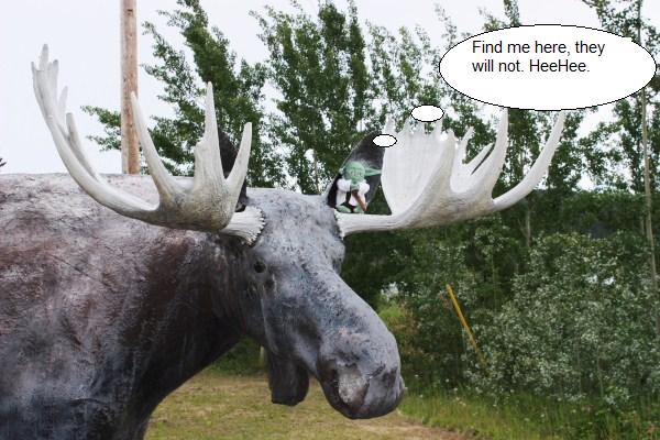
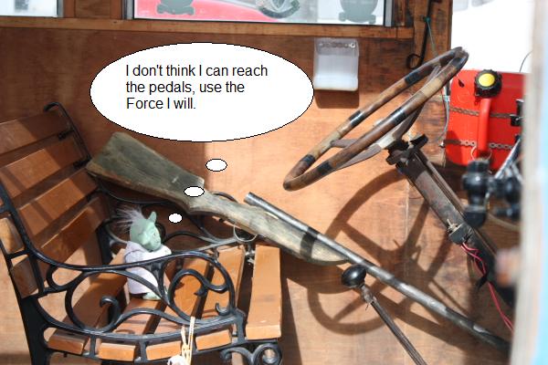
We stopped at a few gift shops then came back to camp. Yoda wanted to play hide-and-seek and I still haven't found the little rascal. Last time I saw him was at the wildlife museum next door.
I took a nap then we had a meeting with the group to discuss plans for tomorrow and ALASKA!!! We head for Skagway tomorrow.
Gas in Watson Lake was $1.09/liter but we got discount so we paid $1.06.
Did not see any (live) wildlife to speak of today.